METZ The Housing and Land Observatory: a useful tool for preserving green spaces and identifying sites for renaturation
Dossier FNAU (Fédération Nationale des Agences d’Urbanisme) n°64
Laurine Brasseur, June 2025
Agence pour l’Environnement et la Maîtrise de l’Energie (ADEME)
In February 2025, the Eurométropole de Metz unveiled the Housing section of its Housing and Land Observatory (OHF), an important step in the implementation of the Local Housing Programme (PLH). This initiative is fully in line with the objectives of the Climate and Resilience Act, which establishes territorial observation as a strategic lever for planning the future of territories, particularly with a view to achieving the goal of zero net land artificialisation (ZAN).
To download : fnau-64-renaturation-metz.pdf (340 KiB)
Why was a Housing and Land Observatory launched in Val de Fensch?
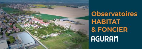
Located in northern Lorraine, the Val de Fensch Urban Community (CAVF) is made up of ten municipalities covering 8,600 hectares and home to nearly 70,000 inhabitants. With 823 inhabitants per km², it is the most densely populated inter-municipal area in Moselle. With a rich industrial and mining heritage, it now faces major challenges in terms of reconversion, in a context of local dynamism stimulated by its proximity to Luxembourg. The inter-municipal authority, which has had a Local Housing Programme (PLH) in place since the end of 2020, has set up the first Housing and Land Observatory (OHF) in Moselle, in particular to meet the objective of zero net land artificialisation (ZAN). Within urban areas, while OHFs primarily identify available land to limit land consumption (brownfield sites, vacant housing, areas for densification, etc.), they must also identify areas to be preserved or renatured in order to achieve a balance between built-up areas and natural breathing spaces. The inter-municipal authority has requested the support of its urban planning agency, Aguram, to carry out the analyses defined by Article L302-1 of the Construction and Housing Code, which provides in particular for a census, within urban areas, of non-impermeable surfaces (particularly open ground) or eco-developable (soil covered by a permeable surface, green roofs and walls, green spaces on slabs, etc.) and undeveloped spaces necessary for maintaining ecological continuity. This observatory provides elected officials with reliable, up-to-date and usable data at the inter-municipal level to guide them in their policy choices regarding spatial planning. The preservation of permeable surfaces is essential for adapting urban spaces to the effects of climate change. These spaces improve rainwater management, both quantitatively and qualitatively, preserve biodiversity, create cool islands and improve the health and living environment of residents.
a reproducible method adapted to the challenges of the territory
A three-step analysis
Identification and categorisation of unbuilt permeable and impermeable surfaces
The identification of unbuilt permeable and impermeable surfaces was carried out using OCS GE2 (large-scale land use in the Grand Est region) data produced by DataGrandEst. This is a very detailed photo interpretation of land use. The data consists of four nested levels, where the level defines the accuracy of the description of the environment. The first level distinguishes between five major land uses (artificial areas, agricultural areas, forest and semi-natural areas, wetlands and water surfaces), which are refined between levels 2 and 4. Finally, a fifth level identifies whether the soil in artificial areas is permeable or not. Agram has cross-referenced levels 4 and 5 of OCS GE2 to create a new land use categorisation based on an analysis of a sample of polygons for each level 4 environment present in the territory. This new land use classification allows for the detailed categorisation of permeable and impermeable undeveloped areas and meets the observatory’s needs: for example, nearly 1,350 hectares of permeable areas are identified within the urban areas of the CAVF, nearly half of which are private gardens.
Identification of areas necessary for maintaining ecological continuity and preventing risks
The permeable surfaces identified in the previous step were cross-referenced with various data relating to biodiversity issues (classified wooded areas, limestone grasslands, ZNIEFF, etc.) and natural risks and hazards (flooding, ground movements, shrinkage-swelling of clay soils) and mining present in the area. A scoring system was created to identify the permeable surfaces that pose the most challenges and therefore need to be preserved as a priority. However, some surfaces that overlap with a single issue were classified as ‘to be preserved’: this is particularly the case for permeable surfaces located in red zones where construction is prohibited under PPR regulations, or in classified wooded areas. This analysis made it possible to re-examine the presence of certain vacant lots, identified as part of the land component, which presented several environmental issues: for example, 157 hectares of permeable areas necessary for maintaining ecological continuity and/or preventing risks were identified within the urban areas of the CAVF (representing 11% of permeable surfaces).
Identification of areas that could be suitable for renaturation projects
Certain areas were then characterised in greater detail to meet the inter-municipal authority’s desire to have an overview of potential renaturation areas within its territory. As the ZAN nomenclature will only apply from 2031 onwards, renaturation is understood here as the (re)creation of natural spaces in the city by improving their ecological functionality (de-impermeabilisation of soils, revegetation, creation of swales, differentiated management of green spaces, etc.).
Green spaces represent around 28% of the urban area of the territory. They have been ranked according to tree cover: green space with no trees/few trees/trees. This categorisation makes it possible to identify both the cool spots to be preserved, in addition to the block centres already identified in the land section, and the green spaces where vegetation can be enhanced and diversified. Unbuilt impervious areas (excluding road and rail networks) represent around 13% of the urban envelope surface area and offer significant potential for de-imperviousisation and greening. Some of these spaces have been specified, to distinguish school playgrounds, car parks and storage areas, squares and sports grounds, which can be de-impermeabilised and vegetated or, in some cases, densified, to avoid impermeabilising permeable surfaces. Unbuilt impervious spaces that are at high risk of flooding or clay shrinkage-swelling have been identified for priority de-impermeabilisation and greening, with a focus on diffuse infiltration. Impermeable areas within school playgrounds have also been identified for renaturation as a priority, even in the absence of biodiversity or natural hazard issues, in order to improve children’s comfort. Green spaces in school playgrounds were targeted for preservation. Thirty-five hectares of green spaces where vegetation could be enhanced and 258 hectares of unbuilt impervious spaces that could be de-impermeabilised/vegetated were identified within the CAVF’s urban areas.
Photo interpretation: advantages and limitations
The inventory of permeable surfaces necessary to maintain ecological continuity is a decision-making tool for elected officials, but it is important to note that it was carried out using photo interpretation and that some processing was done automatically. For example, when identifying ‘areas for densification’, green spaces with a high tree density were systematically excluded. Conversely, a green space with few trees, not affected by the environmental issues analysed, could be identified as an area suitable for densification. Geomatics analysis therefore has its limitations and should be treated with caution because, although vegetation cover is important for the adaptation of urban areas to climate change and the living environment of residents, it cannot, on its own, be used to determine the ecological value of an area. Indeed, some green spaces with a high tree density but consisting of a single species and/or a single stratum are sometimes of less ecological value than green spaces with less tree cover but with a greater diversity of species and strata. The potential identified for enhancing vegetation also does not take into account certain technical constraints, such as the presence of underground networks or soil pollution, which can hinder tree planting. The method implemented as part of the Val de Fensch Housing and Land Observatory has been designed to be replicable in other areas. The analyses must then be adapted on a case-by-case basis, particularly in light of the environmental issues specific to each area. The identification of permeable surfaces necessary for maintaining ecological continuity is a fundamental component of this decision-making tool for elected officials. As the method deployed is based on photo interpretation, it must be accompanied by technical expertise in the field, which is essential to guarantee the reliability of projects. Taking environmental issues into account within urban areas is essential to implementing a path towards land use restraint. As densification is often poorly perceived by residents, providing knowledge about the built environment is an asset in showing that not all spaces within towns and villages are destined to be urbanised and that a balance is being sought.