Rennes: renaturation: challenges and measures, how can we equip local areas?
FNAU (National Federation of Urban Planning Agencies) report 64
Emmanuel Bouriau, June 2025
Agence pour l’Environnement et la Maîtrise de l’Energie (ADEME)
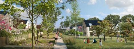
Faced with the imperative of land use restraint and the goal of zero net artificialisation (ZAN) by 2050, renaturation is emerging as a complementary pillar of urban renewal and densification. By re-examining our relationship with the land, the city and nature, it is bringing about a profound transformation in the way we develop our regions. The FNAU aims to identify concrete ways to build, share and implement a territorial renaturation strategy. Here is the example of Rennes (35)
To download : fnau-64_rennes.pdf (210 KiB)
A tool for measuring and monitoring renaturation
Beyond the issue of land use restraint, the implementation of ZAN raises the major question for local authorities of the renaturation of artificial spaces. Cities must adapt to meet the challenges of climate change and ensure a resilient and desirable living environment for their inhabitants. In this context, Audiar has sought to use a digital tool to identify the most suitable areas for renaturing the city in terms of three key dimensions that address the challenges of a sustainable city: biodiversity, climate change and health/living environment. This work is an extension of a method implemented by the Paris Region Institute as part of the European H2020 Regreen project (note) 1, with which Audiar was associated, adapting it to the local scale. The tool aims to project possibilities – which areas are currently affected and what types of space are involved – and to monitor the dynamics of renaturation in the region over time. It thus aims, through the data currently available, to meet the regulatory requirements of ZAN (land consumption and artificialisation), but also to evaluate, at a granular level, the real changes in terms of renaturation and de-impermeabilisation within the urban fabric. In addition to the ZAN approach, this tool also aims to be useful in steering other public policies that incorporate renaturation issues (vegetation coefficient, PCAET, canopy plan, de-impermeabilisation strategy, etc.). In order to provide its members with an operational tool that can be replicated in different areas, the tool deployed in Rennes Métropole was developed using a design and needs-based approach, involving technical partners from the Rennes metropolitan area. These partners contributed to the definition of the indicators and to the testing of the various successive versions, which were enriched as a result of the exchanges. They enabled the tool to evolve in a business-oriented approach, for planners but also for management services, implementing renaturation in a concrete way in the development and day-to-day management of the city. The question of the scale of consideration quickly arose, with a common recognition of the need for more detailed data than the tools proposed by the legislator in order to better take into account the dynamics of renaturation at work on a fine scale in urban fabrics and developed areas. The tool is currently being rolled out, with a test version being trialled by the Rennes metropolitan authorities to take user feedback into account and adapt to needs before it goes live.
Identifying potential areas for renaturation
In order to target the most suitable areas for renaturation, the project team opted for a ‘coarse mesh’ approach, which allows links to be made with the population and jobs in the areas concerned. The INSEE grid was chosen because it met this dual objective. The large 200-by-200-metre grid provides an overview of four hectares per square to define priority urban areas based on three criteria:
-
Biodiversity: tree and herbaceous vegetation, biodiversity reservoirs and functional green and blue infrastructure.
-
Adaptation to climate change: average urban heat island, sensitivity to flooding, sensitivity to runoff.
-
Health/living environment: intense urban heat island, access to green and natural spaces by population density, exposure to nuisances (air quality and noise).
A score is assigned to each component, allowing the grid to be viewed according to its overall score (a single score assigned for each of the nine sub-themes) and/or the scores for each theme, depending on the issues that may be chosen locally by the territory concerned. The aim is to enable users to quickly visualise areas with high renaturation potential via a graduated grid covering the Rennes Métropole area, and to move around and zoom in on the areas of concern. Users can select the overall score, or by category (biodiversity, adaptation and health/living environment) and sub-category. The colours of the grid automatically change between green (low potential) and red (high potential). A histogram shows the distribution of the rating across the different categories and allows the selected area to be compared with a larger area (metropolitan area, municipality, IRIS 2, screen area, etc.). The cursor also provides detailed information at the scale of the grid cell hovered over (thematic scores, population and jobs concerned).
Analysis of land use in potential renaturation areas within the meaning of ZAN
Analysis of renaturation in terms of land consumption and artificialisation
Once the area with high renaturation potential has been identified, the tool allows you to view and analyse the urban composition and land use through the map (MOS), with a graph showing the distribution of the categories in the MOS Foncier nomenclature. This analysis can be carried out on different scales depending on the geographical areas selected (metropolis, municipality, neighbourhood, Iris, grid or screen display). The graph is updated according to the selection (municipality, neighbourhood, IRIS, grid, area displayed on the screen). A selection list allows the user to focus on certain categories (removing certain elements from the nomenclature, such as buildings, for example), updating both the graph data and the spatial data. The tool also allows users to view IGN’s OCS GE data, enabling them to calculate artificialisation as defined by law, broken down according to the needs of the different scales to be analysed.
The limitations of renaturation analysis using ZAN measurement tools
To date, the legislator has defined two concepts and two timeframes for calculating the implementation of ZAN: on the one hand, land consumption through CEREMA figures from land registers (or more detailed local studies, such as the MOS Foncier at the scale of the Brittany Region) and, on the other hand, post-2031 artificialisation through large-scale land use (OCS GE, new generation) produced by the IGN3. These two concepts measure renaturation using defined and mobilised tools, but have significant limitations when it comes to the actual assessment of renaturation. In terms of land consumption, previously urbanised areas that are returning to natural, agricultural and forest areas (ENAF, as defined by the MOS nomenclature) will be taken into account. Some areas may change during infrastructure works (high-speed rail lines, etc.) and create artificially renatured areas (e.g. plots of land within the scope of the works that are returning to agricultural classification). Based on local observations and reflections carried out in other territories 4, it appears that biases exist. It is therefore advisable to supplement the OCS-GE data, which is produced automatically on the basis of quantified assessments, with additional analysis (assessment of urban planning documents, monitoring indicators) or even soil surveys to gain a better understanding of the potential for soil renaturation and restoration 5. The subject of nomenclature continues to raise questions, with large areas of natural grassland within urban areas being considered artificial, even if they have been renatured 6. For example, in Rennes, a former industrial zone of nearly 3 hectares that has been renatured will remain ‘artificial’ within the meaning of the OCS GE, because it is not wooded, even though it has undergone extensive work to restore its natural character. Only a classification by the IGN 7 in application of the decree of 27 November 2023 of the ‘Climate and Resilience’ law would allow for a different accounting of parks and gardens open to the public. The measurement of renaturalised areas using these tools should therefore be treated with caution and requires a more refined approach to ascertain the reality of renaturation.
Going further in identifying potential areas for renaturation
In order to better identify the areas concerned by potential renaturation and monitor the actual dynamics at city level, other data sources have been sought to respond to the fineness of the urban fabric and the sometimes small scale of operations. The IGN’s artificial intelligence land cover data (CoSIA) makes it possible to better identify these areas and understand the actual dynamics of renaturation. Although this data is biased (for example, AI identifies agricultural areas in urban areas or vineyards instead of other annual crops), it has the advantage of being open and free for local authorities, with updates planned every three years and national coverage. The nomenclature of this data has been reworked to correspond to the subject matter and correct certain side effects (e.g. areas defined as agricultural corresponding to urban grassland areas).
Prospects and enhancement of the tool
Beyond the limitations pointed out in the data, the tool developed by Audiar makes it possible to look not only through the prism of the current regulatory framework, but above all beyond it, to support discussions on target sites for renaturation in line with municipal development policies. It offers real value in identifying areas for action. The tool will also make it possible to monitor renatured areas, even outside the ZAN nomenclature, through successive versions (MOS, OCS GE and CoSIA), and to inform discussions and monitoring of other public policies (canopy plan, de-impermeabilisation strategy, carbon storage, etc.). User feedback is essential for the tool to be truly useful to the region, and discussions with the Rennes metropolitan authority will enable the latest modifications necessary for their professional approaches (planning, development, management, etc.) to be made before it goes online.
-
1 IPR, What is the potential for renaturation in Île-de-France? December 2022 (www. institutparisregion.fr/nos-travaux/publications/ quel-potentiel-de-renaturation-en-ile-de-france/)
-
2 Îlots Regroupés pour l’Information Statistique (Statistical Information Clusters), INSEE
-
3 Land consumption reference period 2011-2021 and artificialisation 2021-2031.
-
4 IPR, place of renaturation in the ZAN objective, Copil n° 2, November 2024.
-
5 ADEME work to be published in September 2025 on the subject of the multi-scale approach to integrating soils into territorial strategy (combination of a cartographic approach and field analysis).
-
6 One of the limitations is the detection threshold for areas that may be affected by a change in surface category (2,500 m²).
-
7 The IGN has been commissioned by the Directorate-General for Planning, Housing and Nature (DGALN) of the Ministry for Ecological Transition to create a new database that will be used to calculate land artificialisation. This database will specifically cover public parks and gardens open to the public.